
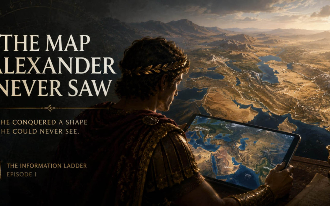
The Map Alexander Never Saw
He conquered a shape he could never see.
Imagine placing a tablet in front of Alexander the Great.
There would be an awkward first minute. The object itself would make little sense: a sheet of black glass producing light without flame, responding to the movement of a finger. You would have to show him that touching one symbol opens a map, that two fingers can enlarge it, and that the small blue lines are rivers rather than decorations. None of this would require explaining satellites, semiconductors, electricity or the internet. Those things could remain completely invisible.
Then type one word.
Macedonia.
Something would change.
The machine would still be incomprehensible, but the information would not. Alexander would recognize coastlines, mountains and names. You could move east across the Hellespont, follow the route through Asia Minor, descend toward Egypt, cross Mesopotamia, continue through Persia, Bactria and toward the Indus. A campaign that consumed years of his life could be compressed beneath his hand into a shape visible in seconds.
That may be the extraordinary part.
Alexander crossed an enormous portion of the known world and created an empire stretching from the Mediterranean deep into Asia. His campaigns also generated geographical information subsequently used by Greek scholars. Yet the exact role of maps in Alexander’s own command remains historically uncertain, and the systematic cartographic world familiar to us belongs to later developments in Greek geography.
Alexander knew the road.
We know its shape.
And those are not the same kind of knowledge.
The Man Inside the Map
Modern maps make conquest look strangely clean. An arrow leaves Macedonia. Another crosses Anatolia. A line bends south toward Egypt and then swings east. Vast journeys become colored routes on a rectangle.
Nobody experienced them that way.
For Alexander and his army, the empire arrived one horizon at a time. There was a river ahead, a mountain pass, a city whose defenses had to be understood, a region described by guides, distances measured through movement, reports arriving from people who had actually crossed the terrain. The campaign itself generated measurements and geographical knowledge; later authors including Eratosthenes drew on information associated with Alexander’s expedition and its bematists, men concerned with measured distances.
This creates a peculiar inversion. Alexander could possess a territory politically without possessing the view of it that an ordinary schoolchild has today.
We open an atlas and see the empire as an object.
Alexander inhabited it as a sequence.
Think about how different those experiences are. A person walking through a labyrinth knows perfectly real things about it: this corridor turns left, that one ends, another descends. Someone looking from above possesses less direct experience of any individual corridor but may immediately understand something the walker cannot: the pattern of the maze.
Neither perspective is automatically false.
One is simply higher.
Aristotle Knew the Earth Was Round
There is an additional irony here because Alexander came from a world that was already capable of surprisingly sophisticated abstraction about the Earth.
Aristotle, who taught the young Alexander, argued that the Earth was spherical. Among the observations discussed in the Aristotelian tradition were changes in visible stars with latitude and the shape of Earth’s shadow during lunar eclipses. Greek understanding of the spherical Earth therefore predates Alexander’s conquest; the familiar story that ancient people universally imagined a flat world is wrong.
But knowing that the Earth is a sphere and seeing your own journey upon the sphere are different achievements.
This is one of those distinctions modern technology has made difficult to appreciate. A child can rotate a virtual Earth, descend toward Asia, locate a mountain range and switch to satellite imagery. None of this feels metaphysically astonishing. It is simply what maps do.
Yet the interface has granted the child something kings lacked.
Not necessarily better intelligence.
A different altitude.
And perhaps this is one of civilization’s recurring tricks. We imagine progress as acquiring more facts, when sometimes the more important achievement is finding a position from which existing facts form a new object.
The road becomes a route.
The route becomes a map.
The map becomes a globe.
The globe becomes one planet among others.
At every stage, something that previously surrounded the observer becomes something the observer can look at.
The Simplest Machine in the World
Give Alexander the tablet long enough and the miraculous part might disappear surprisingly quickly.
He would not need to understand how GPS calculates position. The blue dot simply means you are here. A red pin means there. A line means this way. The entire technological civilization beneath the screen has been compressed into symbols simple enough for someone from another millennium to learn.
That is the deeper importance of an interface.
The complexity does not vanish. It moves downward.
A modern mapping application depends upon technologies, institutions, measurements and infrastructures no individual user holds completely in mind. Yet the final operation can be performed by a child dragging one finger across glass.
Civilization becomes more complicated underneath and simpler on top.
That may also explain why truly advanced technologies often look less magical after they arrive. Their sophistication becomes hidden behind a gesture. The machine no longer asks us to understand it. It asks us to understand a handful of symbols.
And once Alexander understood those symbols, something stranger could happen.
He might stop asking how the tablet works.
He would begin asking what the map allows him to see.
Where does this river begin?
How far is Babylon from here?
Show me the mountains.
Can you show me the route from above?
What is beyond India?
The foreign technology would have become transparent.
The map would take over.
He Conquered a Shape He Could Never See
This is where the thought experiment stops being about Alexander.
We have a great advantage over him because we can stand, conceptually at least, above his journey. We see the campaign as a historical structure. We know which roads eventually led nowhere, which victories mattered for only a few years, which cities became important later, and how little time remained before the king who seemed to be changing the world died in Babylon in 323 BCE. His Asian expedition lasted nearly a decade and produced an empire of extraordinary geographical extent, yet much of the political structure fragmented soon after his death.
From our altitude, patterns become visible that were unavailable from inside the march.
And there is no reason to assume history granted us the highest possible altitude.
We also experience reality sequentially. A year arrives, then another. We make one decision without seeing all the consequences. A company is created. A technology spreads. A political institution becomes normal. A habit becomes identity. We recognize individual roads because we are walking them.
Perhaps what we call confusion is sometimes the experience of living inside a shape whose map does not yet exist.
That possibility matters far beyond geography.
A Roman could live inside an empire whose complete machinery no individual understood. A modern person lives inside financial systems, information networks and technological infrastructures of even greater complexity. We see transactions, devices, institutions and events. We construct explanations from the fragments available at human scale.
But Alexander also had fragments.
What he lacked was the satellite.
One Rung Higher
This is the first step in the Information Ladder.
A higher rung does not necessarily provide the answer to a problem. Sometimes it changes what counts as the problem.
Alexander asks: Which road leads east?
A modern map lets us ask: What shape did the entire expedition create?
Those are questions produced by different observational levels.
The same may be true of consciousness, history, technology and even human mortality. We often assume that the things we cannot understand require more detailed inspection. Perhaps some require the opposite: enough distance for the object itself to appear.
A person living inside an eighty-year life cannot observe human existence the way an imagined consciousness lasting ten thousand years might. A civilization living through the emergence of artificial intelligence cannot yet see the historical shape of that transition. A mind contained within the universe has no obvious external platform from which to inspect the whole system that produced it.
We keep asking for a better map.
Perhaps what we actually need is another rung.
Alexander would probably recognize the world on our screen astonishingly quickly. The mountains would still be mountains. Rivers would still constrain movement. Distance would still matter. What would be foreign was not reality itself.
It would be the perspective from which reality had become visible.
That may be the treasure hidden in the tablet.
We can look down at Alexander and see a shape he spent his life walking through.
The uncomfortable question is whether someone — or something — could one day look down at us in exactly the same way.
And see the map we never knew we were making.
Watch the Video
How to Read the World
Current Knowledge
Alexander III of Macedon ruled from 336 to 323 BCE and conducted a vast military campaign through the Persian Empire and into parts of Central and South Asia. The expedition lasted nearly a decade and greatly expanded Greek direct knowledge of regions to the east. Later geographical scholarship drew upon measurements and reports connected with Alexander’s campaigns, including information associated with his bematists.
The exact use of maps by Alexander and his commanders is not fully recoverable from the surviving evidence. Scholars caution that the place of cartographic maps in Alexander’s geographical knowledge is controversial; it would therefore be misleading to picture him simply carrying an ancient equivalent of a modern campaign atlas.
Greek thinkers of Alexander’s period were already familiar with the idea of a spherical Earth. Aristotle offered arguments for Earth’s sphericity, and later Hellenistic scholars—most famously Eratosthenes—developed geographical measurement much further.
The detailed, unified and continuously scalable view offered by modern digital mapping is nevertheless fundamentally different from the fragmentary geographical representations available in the fourth century BCE.
Open Questions
How much does a new perspective change intelligence itself? If Alexander had possessed perfectly accurate global maps, would he merely have made the same decisions faster, or would entirely new strategic questions have become conceivable?
More broadly, how many systems do modern humans currently inhabit without possessing an adequate „map” of them? Economic networks, artificial intelligence, culture and consciousness can all be examined locally, but does accumulation of local knowledge eventually produce the whole—or is a new observational level required?
And how would we recognize that such a level had become available? Would it appear immediately revolutionary, or would it eventually become another blue icon on a screen that children use without thinking?
Transhumation Interpretation
Transhumation reads Alexander’s missing map as a model of perspective limits, not as evidence that ancient people were intellectually primitive.
A structure can be real, consequential and navigable before anyone is capable of seeing its complete shape.
The walker experiences the road.
The cartographer sees the route.
The satellite reveals the landscape containing both.
The Information Ladder proposes that knowledge may sometimes progress in this fashion: not merely by adding information, but by reaching a level from which the previous level becomes visible as a structure.
This is also why symbols and interfaces matter. They allow enormous complexity to be compressed into forms usable by minds that do not understand every layer beneath them. The blue dot on a digital map conceals technologies Alexander could not imagine while presenting a relationship he could understand immediately:
You are here.
Perhaps many of our deepest mysteries have the same form.
We know where we are locally.
We know some of the roads.
What we do not yet know is the shape.
And somewhere above the level from which we currently look, there may—or may not—be a map.
FAQ
Did Alexander the Great use maps?
The surviving evidence does not allow a simple answer. Alexander and his commanders possessed substantial geographical knowledge, measurements, itineraries and reports, but historians debate the exact role of cartographic maps in his campaigns.
Did Alexander know the Earth was round?
The idea of a spherical Earth was already present in Greek philosophy during Alexander’s lifetime. His teacher Aristotle explicitly argued that Earth was spherical, although this does not tell us exactly what Alexander personally believed or how much the idea affected his campaigns
Did Alexander’s campaigns improve geographical knowledge?
Yes. His expedition produced information about large parts of Asia, and measurements associated with the campaigns were later used by Greek geographers, including the tradition drawn upon by Eratosthenes.
What does “He conquered a shape he could never see” mean?
It describes the difference between moving through territory and possessing a modern overview of that territory. Alexander experienced his empire as roads, journeys, cities and regions; modern observers can see the whole route compressed into a single map.
What is the Information Ladder?
In Transhumation, the Information Ladder is the hypothesis that some advances in understanding come not from accumulating more facts but from reaching a new observational level from which earlier information becomes visible as a larger structure.
What is the main Transhumation question?
The article asks whether modern humanity may be in Alexander’s position: capable of living within, using and even influencing structures whose complete shape remains invisible from our current level of observation.
Continue the Transhumation Series
- Forgotten Religion | Ancient Gods, Symbols and the Hidden Structures of Human Civilization
- The Last Religion | Death, Immortality and the Future of Humanity
- The New Theurgy | AI, Information and the Future of Human Civilization
- End of Branding: You Were Never Meant to Become a Product
- Baal vs Ishtar: Why Ancient Gods Never Disappeared